The Osher Inn’s light-filled lobby and interior walk-ways are filled with historic maps, a special gift from the Osher Library Antique Map Collection. Visitors and residents enjoy the stories these maps offer about the history of the world and times of our ancestors including world maps from great cartographers, lore of ancient Jerusalem, and maps and lithographs of Portland with interesting vignettes of the time.
Photos of select maps:
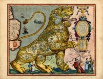
Europe 1617 Leo Belgicus
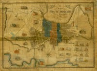
Map of the City of Portland with the Latest Improvements, John Cullum, 1836
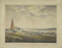
View of the Entrance of Portland Harbor Encampment of the Rifle Rangers of Boston, Charles Codman 1830